Author: abelt


OPINION: CLEAN AIR EVERYWHERE, FOR EVERYONE IN WASHINGTON

A precious Cascadian place makes the New York Times

Protecting Ecotopia’s Bioregions
A Coast Salish inspired throw blanket adorns my couch. In a pandemic constrained world, its now the centerpiece of my Zoom videoconference background yielding several complements. Designed by Nooksack/Chinese/French/Scottish artist Louie Gong and founder of the Eighth  Generation Shop (eighthgeneration.com) at Seattle’s Pike Place Market, a Hummingbird pattern occupies the center composed of, and surrounded by geometric forms common to Coast Salish designs. This “three-rhythm” pattern of angular stripes shaded light, medium, and grey was described in a 1929 American Anthropologist publication.
My throw sets up a borrowed but modified analogy from Quammen’s 1996 book The Song of the Dodo: Island Biogeography in an Age of Extinctions. Imagine lifting the blanket for a closeup of the weave. Wool threads compose a complex and three-dimensional tapestry. Then, take a dull knife and start slicing randomly at the fabric. The cuts sound like gasps from the long dead. Tattered remains number over two dozen. Uneven pieces pile up with distinct sizes and angles.
Severed fibers protrude from all the edges. The hummingbird is no longer recognizable. So, did we make more than a dozen new Salish blankets? Do the shreds offer any utility now? Hardly. All we are left with are ragged and frayed fragments, each one certainly worthless and commencing to come apart.
Now, apply this same logic to some of the Pacific Northwest’s iconic environments. This provides an organizing metaphor to understand the challenges of ecosystem governance in the transboundary bioregions shared across the northwestern border of the U.S. and Canada. The Cascade and Coast Range mountains stretch across 188 thousand square miles from Canada’s Yukon to Northern California. Temperate rainforests, fjords, valleys and rivers create 47 ecoregions blanketing British Columbia (BC) and Washington (WA). “An ecosystem is a tapestry of species and relationships. Chop away a section, isolate that section, and there arises the problem of unraveling” (Quammen 1996, p. 11).
In Washington for instance, a 788 page government opus reported that the state lost 90 percent of old growth forest, 70 percent of estuarine wetlands, 50 percent of shrub-steppe habitat, 70 percent of arid grasslands, and 50 to 90 percent of riparian habitats. Ecologists, biologists, and wildlife managers have been studying and trying to stop the Cascadia terrestrial and coastal ecosystems (see below) from unraveling even more since the 1970s.
In one Cascadia conception, snow-capped mountains fuel rivers of falling waters and their salmon coursing through North America’s temperate rainforests. The Cascadia bioregion resembles a green wedge stretching from Alaska’s Icy Bay to California’s Cape Mendocino on the coast and inland to the Continental Divide and Yellowstone National Park in Wyoming. But, human fragmentation in the form of borders, highways, suburban, and urban development divide our shared ecosystems. For instance, in August 2018, I saw this an unnatural strip of clear cut rising from a dried up dam reservoir scarring this Cascadia scene.

“They mow the border?” exclaimed one observer incredulously. Indeed, he discovered, treaties require the US and Canada to maintain a “clear line-of-sight vista for the entire 5,526 mile border. So, they poison it with herbicide as well. I photographed the landscape above straddling the US and Canadian border in the emptied northern edge of a dam reservoir. Arguably, this may be the locus of bioregionalism’s birth in Ecotopia.
Nearly 30 miles to the south and 50 years ago, Seattle’s electric utility planned to raise its Ross Dam 122 and-a-half feet. Its unnatural lake would expand ten-fold and inundate more than seven miles of Canada’s Skagit River Valley. Canadian environmentalists rallied around protecting a free-flowing river and its streamfishing according to one account. South of the border, US environmentalists proposed a single large and binational conservation area at the center of Cascadia in 1971.
Presented as the “Salish National Park” for Canada in opposition to Dam expansion on the Skagit river, activists sought to match the North Cascades and Pasayten National Parks in the United States (US). But, British Columbia (BC) forestry officials informed a US Park superintendent that “they planned to log every possible inch of BC right up to the international boundary” (Louter 1998, p. 311). The single large conservation area idea hung on through the eighties but probably peaked in the nineties.
A book Cascadia Wild: Protecting an International Ecosystem appeared in 1993 with a new map. It proposed a core binational protected area encompassing 2.5 million wilderness acres in the US and over 300 thousand in Canada. Its buffer zone encompassed several rural communities. Marketed through a poster for the 1994 conference “Nature Has No Borders,” government officials, politicians, researchers, and environmentalists representing both nations imagined a new transboundary park.
But, according to a case study in the book Protected Areas and the Regional Planning Imperative in North America, the “Greater North Cascades Ecosystem” fell victim to a conservative backlash and national antigovernment trends. Conversely, a nearby marine bioregion gained momentum in 1994. A symposium on a coastal marine ecosystem shared between BC and WA also convened government ministers, officials, and scientists. They addressed questions about the sustainability of the current and projected development on the Strait of Georgia, Puget Sound, and Juan de Fuca Strait.

When you count Native American Tribes, 54 nations and hundreds of sub-national jurisdictions share the inland Salish Sea pictured above. Its drainage basin encompasses 45 thousand square miles where over 7 million people reside. According to one transborder atlas, the region’s population will grow by 1.9 million residents over the next 15 years. This growing human pressure throughout the Salish Sea presents significant challenges for this marine ecosystem.
Yet, this may be the first new North American ecosystem mapped in what several environmental historians call “the age of ecology” like Joachim Radkau, Daniel Press, and William Ophuls.

Toxic policy contrasts in Ecotopia
Recently, my research on air toxics and environmental inequality in U.S. states revealed a significant policy difference likely responsible for environmental justice progress in Oregon but regression in Washington. Turns out, there’s not cleaner air for everyone, everywhere in Ecotopia.
Washington State’s Department of Ecology (ECY) and the Puget Sound Clean Air Agency (PSCAA) rely on the minimum and 1990s-era “source-control” strategy for air toxics control. Conversely, OR developed a cumulative and geographic area strategy in addition to their source-control policy through Ambient Benchmark Concentrations (ABCs). While OR’s ABCs are guidelines instead of legal standards, they drive a more active air toxics control program. Moreover, it’s probably better funded.
OR spends nearly twice as much per resident on environmental protection than WA. In 2015, OR directed $875 Million to its environmental agencies compared to WA’s $828 million. Yet, WA has nearly double the population of OR; 7.1 Million to four Million. So, WA’s environmental budget also seems stuck in the nineties. In policy circles, analysts also might add that WA’s air quality professionals are avoiding the delineation of problems they don’t have money to address.
OR clearly demonstrates “beyond compliance” efforts and a more responsive air toxics strategy. However, California and Massachusetts represent the most advanced states for air toxics regulation. In other words, CA and MA are leaders (A students), OR in a second tier (B students), but WA is a laggard (a C student at best). WA may be compliant, but comparatively they also look relatively complacent and unresponsive. We are long overdue for an air toxics strategy overhaul in WA to catch up with OR, CA, and MA.
Compliant Source Strategies versus Beyond Compliance Responsiveness
First, it’s important to recognize that the U.S. Environmental Protection (EPA) never established ambient or area-based air toxics standards in the Clean Air Act Amendments (CAAA) of 1970. However, the 1990 Amendments directed EPA to promulgate standards for the sources of 187 “air toxics” known as the National Emission Standards for Hazardous Air Pollutants (NESHAPs). Moreover, the 1990 CAAA defined sources to be regulated if they are a “major source” by emitting or potentially emitting 10 tons per year of any of the 187 air toxics or 25 tons of any combination of air toxics.
Congress also established what some call a “residual-risk bright line” for determining acceptable public exposure to air toxics in the CAAA. Thus, EPA was directed to assure that the increased lifetime cancer risk from exposure to an air toxic must not exceed one in a million (10-6) for an effected population. This is the floor that no state program should fall below. Our nation’s air toxics regulation and monitoring system routinely gets poor grades from nonpartisan government evaluators from the Government Accountability Office (in 1991, 2006, and recently) and the EPA’s Office of the Inspector General (in 2005, 2010).
WA complies with NESHAPs through its establishment of Acceptable Source Impact Level (ASIL) for 430 air toxics. While that’s more pollutants than EPA identified, I wouldn’t judge WA’s effort as beyond compliance. Washington’s air toxics program only covers sources of HAPs while OR’s addresses ambient or geographic area air toxics thresholds. For instance, we learned at the last Duwamish Clean Air Program meeting that Ardagh glass is well-within the ASIL threshold for chromium and other air toxics. But, this reveals what most see as a major limitation. WA’s air toxics management only considers single sources independently or piecemeal and ignores cumulative impacts.
For example, if there are three WA facilities in the same geographic emitting 5 tons of an air toxic or some combination, they escape regulatory scrutiny. The CAAA classifies them as a small stationary source instead of a major source. Yet, their cumulative impact of 15 tons of an air toxic exceeds one facility emitting 12 tons of air toxics and regulated by CAAA regulations as a major source. So, ignoring the cumulative impacts of several sources leaves a gaping regulatory blind spot for air toxics in WA. Since pictures are worth a thousand words, I’ll display two contrasting approaches to risk assessment and management on the following page from one of EPA’s first conceptualizations of cumulative risk assessment. The left figure captures WA’s approach while the second OR’s.

Contrasting Population-based and chemical-focused risk analysis.
On the left, imagine an industrial source as the stressor with WA air toxics regulators considering facilities in isolation during the permitting process. OR also regulates sources and developed similar source-based threshold values like WA’s ASIL standards. As described in OR’s 2003 air toxics staff report, “These standards, while important to reducing emissions from major sources, do not consider the cumulative effects of multiple small and large sources in populated areas” (p. 4). Thus, OR developed a geographic strategy through ambient air toxics benchmarks as well.
In 2006, OR adopted established Ambient Benchmark Concentrations (ABCs) for geographic areas at one in a million excess lifetime cancer risk accounting for sensitive populations. That program further directed OR’s Department of Environmental Quality (DEQ) to prioritize areas where ABCs posed excess cancer risks above 10 in one million for mitigation. This cumulative and geography area air toxics strategy led to the 2012 Portland Air Toxics study starting with the following statement. “Forming individual airsheds based on geography allows the Department of Environmental Quality or DEQ to define problem areas for air toxics in Oregon. It also allows DEQ to prioritize and focus efforts to reduce air toxics. Under this geographic approach, DEQ and community members evaluate air toxics holistically in an area, striving for reductions from various sources roughly commensurate with their contributions” (p. 3).
In 2018, OR completed a rulemaking overhaul of its air toxics program titled Cleaner Air Oregon (CAO). “The long-term goal of Cleaner Air Oregon is to achieve a 50% reduction in the number of existing sources posing either an excess cancer risk of more than 25 in a million or a Hazard Index of more than 1 by the year 2034” (p. 3). This law follows CA’s 1987 requirements that large and small stationary sources likely producing cancer and noncancer risks above benchmarks estimate their air toxics hazards and reduce emissions to meet health-based standards. Companies instead of communities must now prove they are safe for their neighbors. If they aren’t safe enough, polluters must develop toxic pollution prevention plans. Last year, the first 20 companies were selected for CAO review. WA’s air toxics strategy looks pretty impotent in comparative terms.
In conclusion, WA is an exemplary laggard when it comes to regulating and reducing air toxics. In our study of state-level inequality trends published last year (Salazar et al. 2019), WA was one of six states (with Alaska, Louisiana, Missouri, New York, and North Dakota) where the worst level of toxic exposure (90th percentile) increased along with race-based environmental inequality between 2004-2014. For the nation, industrial toxic exposures fell dramatically while environmental inequality persisted. Both got worse in WA however (See Figure 1 in our article: SalazarD_etal_2019_US_state_environ_inequality_SSQ100n3). Toxic exposures and racial inequality improved in OR. Thus, while OR saw facilities getting both safer and their exposures more just, WA’s got riskier and more unjust.
Greetings from Cascadia & Ecotopia
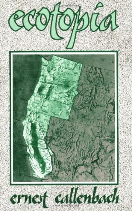
I first saw Ecotopia in 1986. Wandering around the college bookstore as a wide-eyed freshman, I began accumulating the texts of major scientific disciplines. Biology, geology, chemistry, and calculus were on my list. But for English 101, the instructor assigned Ecotopia Emerging for the main text. This wasn’t your typical first-year composition book. Ernest Callenbach published his second fictional novel in 1981. It was a prequal.
In his first book Ecotopia, readers discovered stories of a new American nation’s birth. It formed when California as far south as the state’s Tehachapi Range joined Oregon and Washington in secession from the United States. Callenbach presented fictional dispatches from a journalist reporting on the world’s first ecologically friendly nation. Combustion engines and pesticides were banned. Toxic pollution was fanatically eliminated. Women controlled politics and government. African-Americans gained self-rule in several city-states. Oakland was renamed Soul City. Football disappeared.
Just one year after I saw Ecotopia, it got its own catchphrase. “Development that meets the needs of the present without compromising the ability of future generations to meet their own needs” (p. 41). The authors of Our Common Fu ture coined the idea of sustainable development in 1987. Many portray sustainability as the harmonious nexus of ecology, economy, and equity popularized through a Venn diagram of three overlapping circles. Some fashionably advocate a triple-bottom line concept.
Now often shortened to sustainability or sustainable, the term now is ubiquitous in environmental writing and especially in urban studies and planning. For example, in a chapter on sustainability in planning, Beatly attributed Seattle with mainstreaming the sustainability idea in their 1994 comprehensive plan. Subtitled “Toward a Sustainable Seattle: A Plan for Managing Growth 1994-2014,” it expressed four core values for the city: community, environmental stewardship, social equity, and economic opportunity and security.
Seattle is often touted as a hallmark of sustainability because it launched the first indicators program, ranked first in Portney’s 2003 ranking of cities taking sustainability seriously, and won the US Environmental Protection Agency’s 2003 Climate Protection Award.
Conversely, a growing number of voices question Seattle’s environmental reputation. Matt Klingle’s Emerald City: An Environmental History of Seattle revealed a long history of environmental degradation and social injustice. Likewise, Sanders alluded to a side of Seattle in Seattle and the Roots of Urban Sustainability: Inventing Ecotopia that is not “. . . a story of black and white, of total success or total failure of ideals, but rather one as gray as the recycled water that Ecotopians sprinkled on their gardens. The down side of this greener urbanism may have been its tendency to reinforce a trend toward a more fractured landscape in a city that would become increasingly out of reach to working and middle-class families” (p. 214).
Likewise, one state environmental scholar regularly updates a state environmental policy assessment for the anthology Environmental Policy: New Directions for the 21st Century. In the eighth edition published in 2013, Rabe reported rankings of state adoptions of 20 different environmental policies with California (CA) in the lead for 20 different environmental policies in 2010 with Oregon (OR) among a second tier of states with 18 adoptions and Washington (WA) close behind with 17. Three years later, CA remained in a top tier of states for environmental policy commitments while OR and WA remained in a second grouping. Generally, some states like CA, OR, and WA consistently rise to the top in evaluations of environmental protection policies, others are regularly in the middle, and another cluster stay at the back of the pack.
But, in the more recent book The Divided States of America: Why Federalism Doesn’t Work published this year, emerging research benchmarking state environmental performance on air, climate, and energy was presented. Public policy scholars covered in a chapter called “E Pluribus Plura” offered a new twist by focusing on environmental results rather than just policy commitments. Riordan Frost and Daniel Fiorino normalized air pollution, carbon emissions, and energy efficiency efficiency by a states gross economic output. California remained at the top of the rankings but with a sizeable lead over over states in the top ten. Oregon and Washington fell ninth and tenth respectively. However, they trailed CA by nearly 100 points while beating the state average by only 10 points.
Thus, Ecotopia saw remarkable variation in environmental results across its three states. Only with comparative policy analysis do we uncover these important differences and their implications. I intend to continue the challenging work of connecting environmental policy variations and similarities with divergent results in a three-dimensional (3D) lens.
Sustainability planning conflicts also will be a frequent topic in this space. For instance, Scott Campbell countered that optimistic depiction of balancing economy, ecology and equity to produce sustainability. “Planners have to redefine sustainability, since its current formulation romanticizes our sustainable past and is too vaguely holistic” he wrote in 1996 (p. 296). Describing a planner’s triangle instead, he focused on the contradictions of sustainable development in the Journal of the American Planning Association (JAPA).
First, a resource conflict pits economic growth and jobs against environmental protection. Economy represents one of the triangle’s three points while ecology and equity form the other two. The second divide involves social justice versus environmental protection in a development conflict. Third, a property conflict divides economic growth and social justice. Ten years later, David Godschalk added a livability point in another JAPA publication.
A growth management confli ct divides economic growth and livability while gentrification cleaves livability and equity. Last, a green cities conflict divides livability from ecology. The result is a 3D “sustainability/livability” prism with six conflicting planning challenges. In my applications of this framework and its conflicts across the cities and regions of WA, OR, and CA, I rename it Ecotopia’s Prism.
For more background on the course of my scholarly life, please see my curriculum vitae. AbelT 2023 CV Sep
- 2 of 2
- « Previous
- 1
- 2