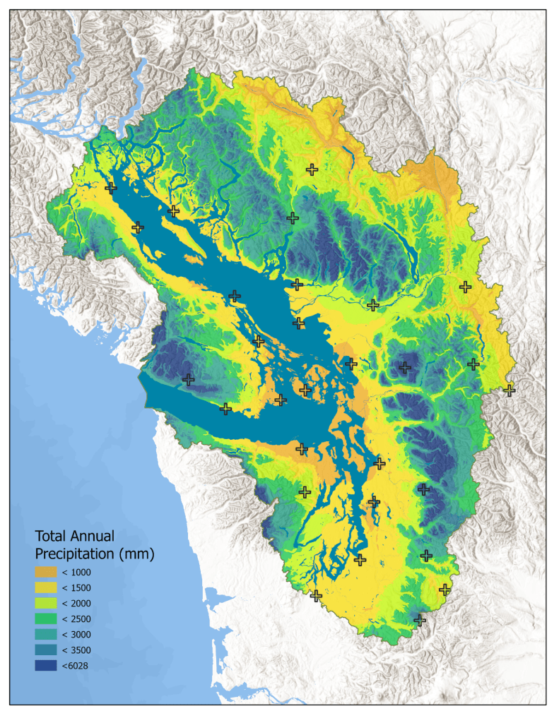
The “Climate of the Salish Sea Bioregion” chapter of the Salish Sea Atlas was selected as one of the best map series at the 2023 ESRI User Conference!
The Salish Sea Bioregion’s diverse topography and hydrology create patterns of local climate that vary impressively across relatively small distances. For example, annual precipitation at high elevations in the Cascade Range or Coast Mountains can be more than 10 times that at low-elevation sites in the rain shadow created by the Olympic Peninsula and Vancouver Island.
Open the Climate chapter to explore the spatial patterns of temperature, precipitation, and wind variables across the Salish Sea Bioregion.
The maps in this chapter use a combination of climate station records and gridded, interpolated climate surfaces with averages calculated for the 1991-2020 period.
